Peace of Mind with In-flight Weather
Pilots ideally want to have access to the latest weather while en route in their aircraft. However, not many general aviation aeroplanes have weather radar equipment. Garmin offers a package for G1000 flyers to get satellite weather in the G1000 equipped glass cockpit aircraft. Avidyne offers a similar package. Now, AeroPlus offers a datalink option that works from your iPad in combination with a hotspot device from Iridium.
Wifi Hotspot
Those of us that do not have the above glass cockpit weather option installed in the aircraft, now have a good alternative available to them: Iridium GO! in combination with the AeroPlus Aviation Weather app for iOS (iPhone | iPad).
The Iridium satellite network coverage is from pole to pole. It consists of 66 active satellites in orbit, and some additional spare satellites to serve in case of failure. It was developed in the 1980s and became commercially available in the late 90s. It is the only satellite network with worldwide coverage. Iridium is launching new satellites into orbit in 2016 and 2017. These satellites will fill in some gaps from defect and old satellites and when the launch program is completed, the new satellites will also provide a better speed for data transfer.

Aircraft equipped with AeroPlus datalink weather solution.
Even though the Iridium satellites do not offer you at this moment the data speed to be able to watch YouTube movies while in-flight, the speed is good enough to get you the latest weather and rain radar imagery within just a few minutes of time. Also, you can make or receive voice calls, send text messages and even update your Twitter account. Don’t expect to be browsing the internet over the Iridium satellite network. That won’t work.
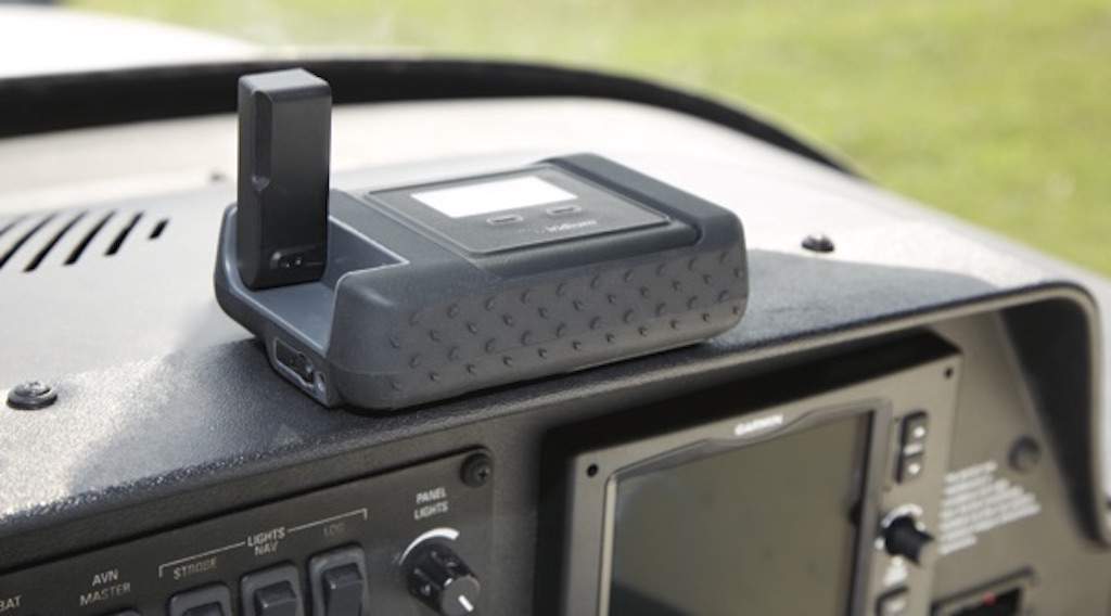
The Iridium GO! mounted on top of the dashboard in a single engine piston (SEP) aircraft.
To get the best out of an Iridium satellite connection, keep the following in mind:
- Get a full signal before downloading any data. Full signal = 5 bar signal.
- Make sure the antenna has an unobstructed view of the sky. If you use the Iridium GO! in your aircraft, consider getting an external antenna: either a suction cup aviation antenna or an external roof antenna.
- Keep your messages and data requests simple and short. The Iridium satellites run from pole to pole in about 7 minutes. After that, the satellite has to pass your connection to another satellite. This “handshake” can disturb your message delivery or delay it, so keep them short.
- Do not compare the Iridium satellite network to your Wifi network at home or your 4G mobile connection. Iridium designed their satellite system in the 80s. It works very well if you stay within its limitations.
In-Flight Aviation Weather
Iridium offers third parties the option to develop apps that work optimally with the Iridium GO! We are a partner with Iridium and have adjusted our weather app for iOS to bring the latest aviation weather into your cockpit. You can download METAR, TAF and GFS weather model data from anywhere in the world. A rain radar overlay with lightning data is available as well.*
* Rain radar data is available only in North America, Central America, Europe, Australia, and in parts of the Pacific. Offshore it is not always available. The METAR, TAF and numerical weather model data are available worldwide. The lightning data is available nearly worldwide, except for roughly the areas at the poles, most of Russia (except the Vladivostok area), the southern part of South America, Greenland and Iceland.
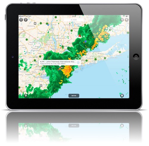
Downloading textual weather data goes fast. The textual weather information for a particular airport takes anywhere from 30 seconds to one minute to download. You can download the textual weather for nearby stations at the same time as well and the download will still take in most cases take less than 2 minutes. Downloading a rain radar map overlay takes anywhere from 2-5 minutes to complete, depending on the signal strength (how many bars) of the Iridium connection. It takes about 30 seconds to build up a data call connection after which time the download will start. The whole connection and download procedure with the Iridium GO! device and Iridium satellite network is managed from within our weather app. If you are using something else like, for example, a Thuraya connection, then you have to manage the satellite connection yourselves.
What separates Iridium Go! from Others?
There are several other satellite weather solutions around based as well on Iridium technology. Most offer aviation weather provided over the Iridium network, but the device then works with a different Iridium chip called the Short Burst Data (SBD) chip. That chipset does not support voice calls. The Iridium GO! offers voice communication next to data.
Voice Calls & Weather Data
You can link up to five smartphones to one Iridium Go! over an internal Wifi network created by the Iridium GO! in the aircraft to receive or make phone calls as well as get the latest en route and destination weather.
Call using your Bluetooth Headset
If you use a Bose A20 or other Bluetooth headset, you can use your noise cancelling headset to make clear phone calls from your smartphone through the Iridium GO! to ground based stations. Being able to make voice calls is especially beneficial when crossing oceans. You can use the voice call feature to inform the destination airport, car rental company or your friends when you are arriving later than expected.
Iridium Go! Features
Iridium GO! offers you the following features:
- Make phone calls from your iPhone/Android phone over the Iridium satellite network;
- Use your Bluetooth-connected headset to make the calls;
- Connect to the device over a Wifi connection;
- Receive voice calls and SMS messages for free;
- Connect 5 smartphones or tablets to the Iridium Go! at the same time over Wifi;
- GEOS rescue service subscription included;
- Unlimited data subscription option available;
- Flexible Iridium subscription plans including pre-paid options;
- GPS Tracking at 5-minute or longer intervals;
- Waterproof housing and thus easy to bring along on your boat or trip away from the aircraft;
- Support for external aviation and marine antennas.
- Send short e-mail/SMS/text messages for a third of the data rate price.
Screenshots of Iridium Go in Action!
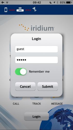
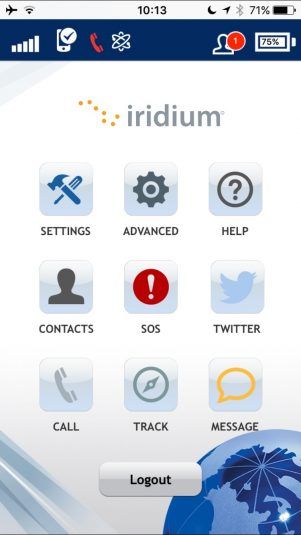
Connect your iPhone or iPad to the Iridium GO! Device over the Wifi connection created by the Iridium GO! in your aircraft. You can create separate user accounts in the Iridium GO! Device and five persons on board can connect at the same time to the Iridium GO! over Wifi. The signal strength (5 bars) is clearly visible and next to the red phone icon in the top bar you see the symbol telling you that the data connection is up and running.
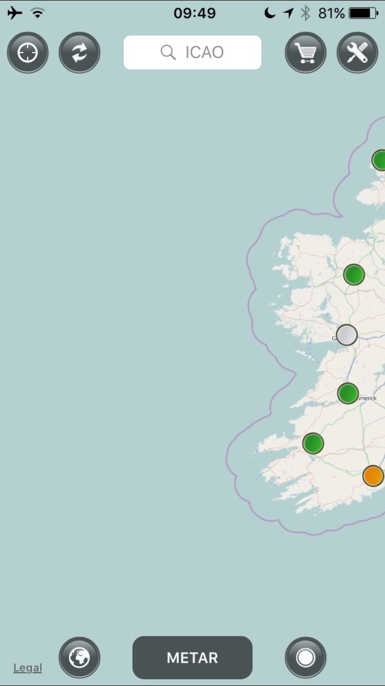
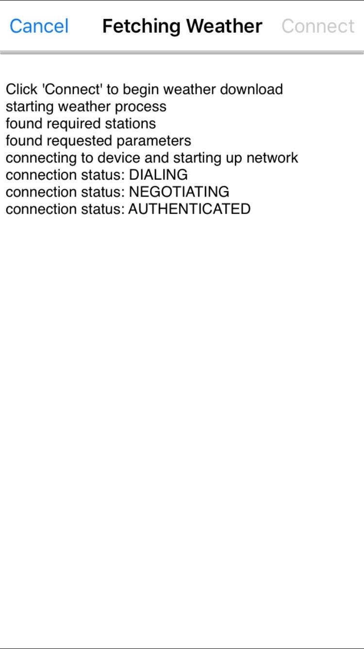
Fetch the latest weather data from the app. Select the area for which you want to receive rain radar data and press the refresh icon on the screen (top, second button). The app will initiate a download session and will even set up the outbound connection to the Iridium satellites for you and disconnect again after it has downloaded the weather.
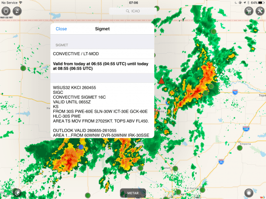
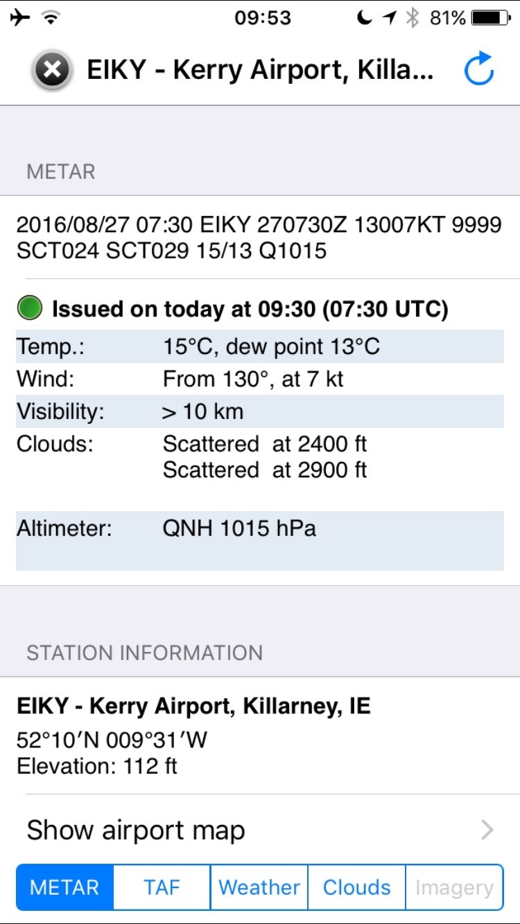
After 2-5 minutes, depending on how strong your Iridium satellite connection is, you will get the latest rain radar data. The weather for airports including METAR, TAF, GFS-model data such as freezing level, winds aloft and a clouds diagram are downloaded per individual airport. The download of airport weather often takes less than one minute, but if the Iridium GO! does not have an optimal sight on the satellites, it might take 1-2 minutes to download.
Another example
We are flying west of Italy and request for a rain radar overlay. Within our app we initiate a data call through the Iridium GO! and a few minutes later, the rain radar data is there. We can zoom in in the usual way on our iPad or iPhone screen. Just zoom into the area for which you would like to receive rain radar data before initiating the download, then that is the area for which you will receive the data.
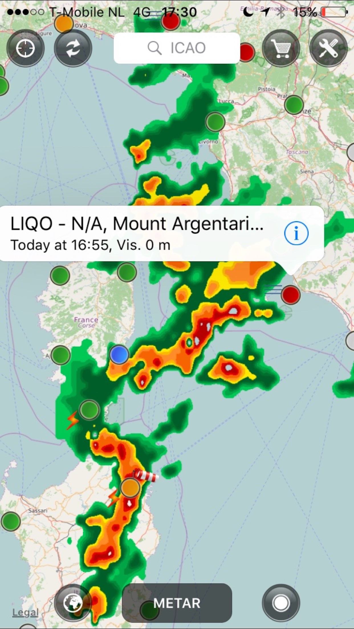
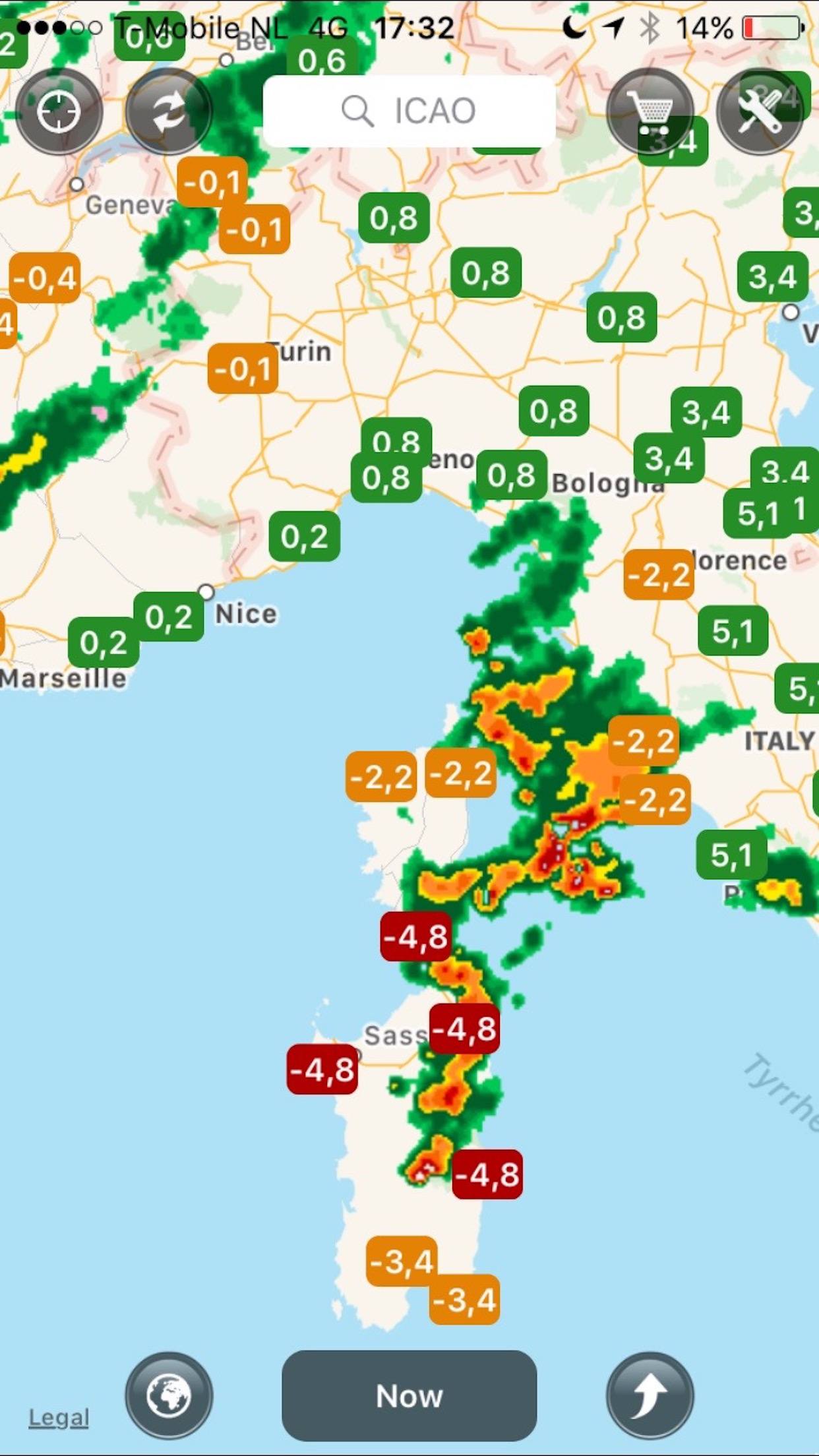
The above screenshots show the zoomed in rain-radar overlay. The right screenshots show the lifted index values. We are also interested in the latest weather for LIQO. LIQO does not provide TAF forecasts, but the rest of the information is downloaded within minutes as we do on our iPad. For airports that do provide TAF data, the TAF is of course also provided. Below a screenshot of how the area looks from an iPad perspective/screen.
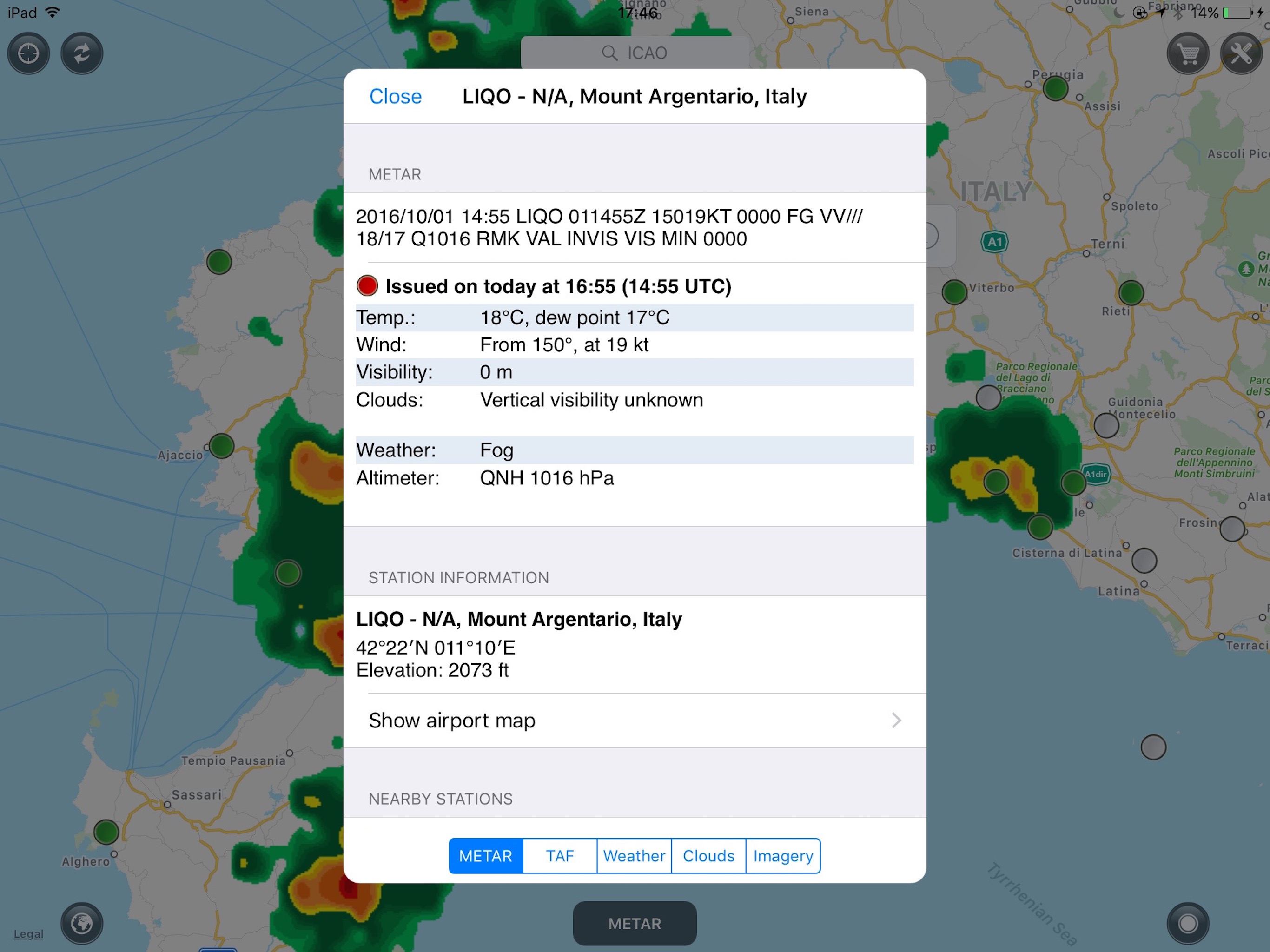
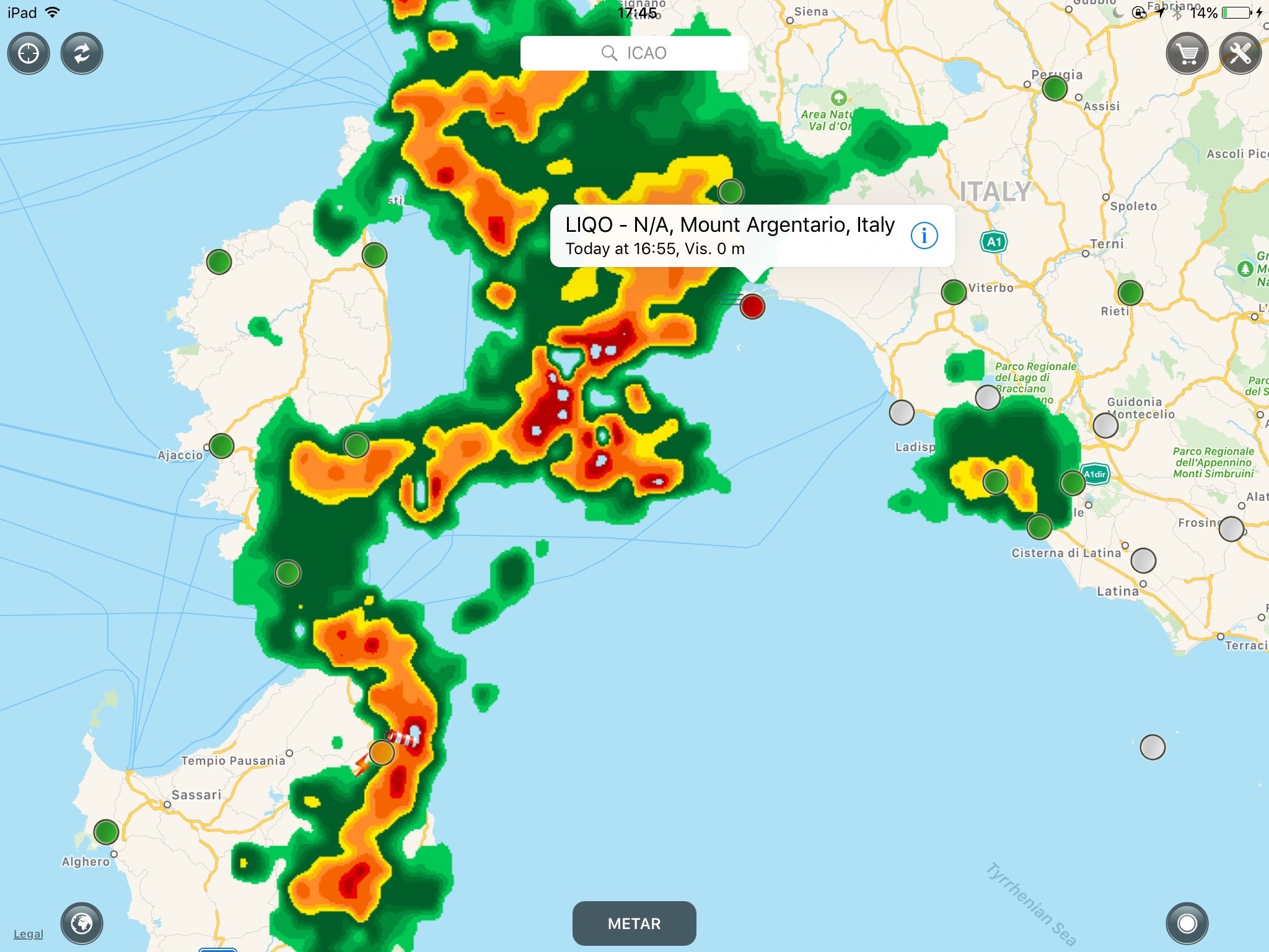
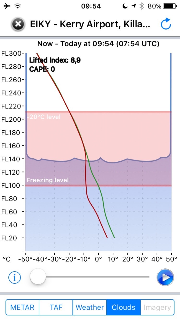
Togehter with the METAR and TAF data, additional weather model data is downloaded for this airport and area as well. The METAR provides actual weather, while the “Weather” and “Clouds” tabs provide you with the most recent forecasts based on numerical weather models.
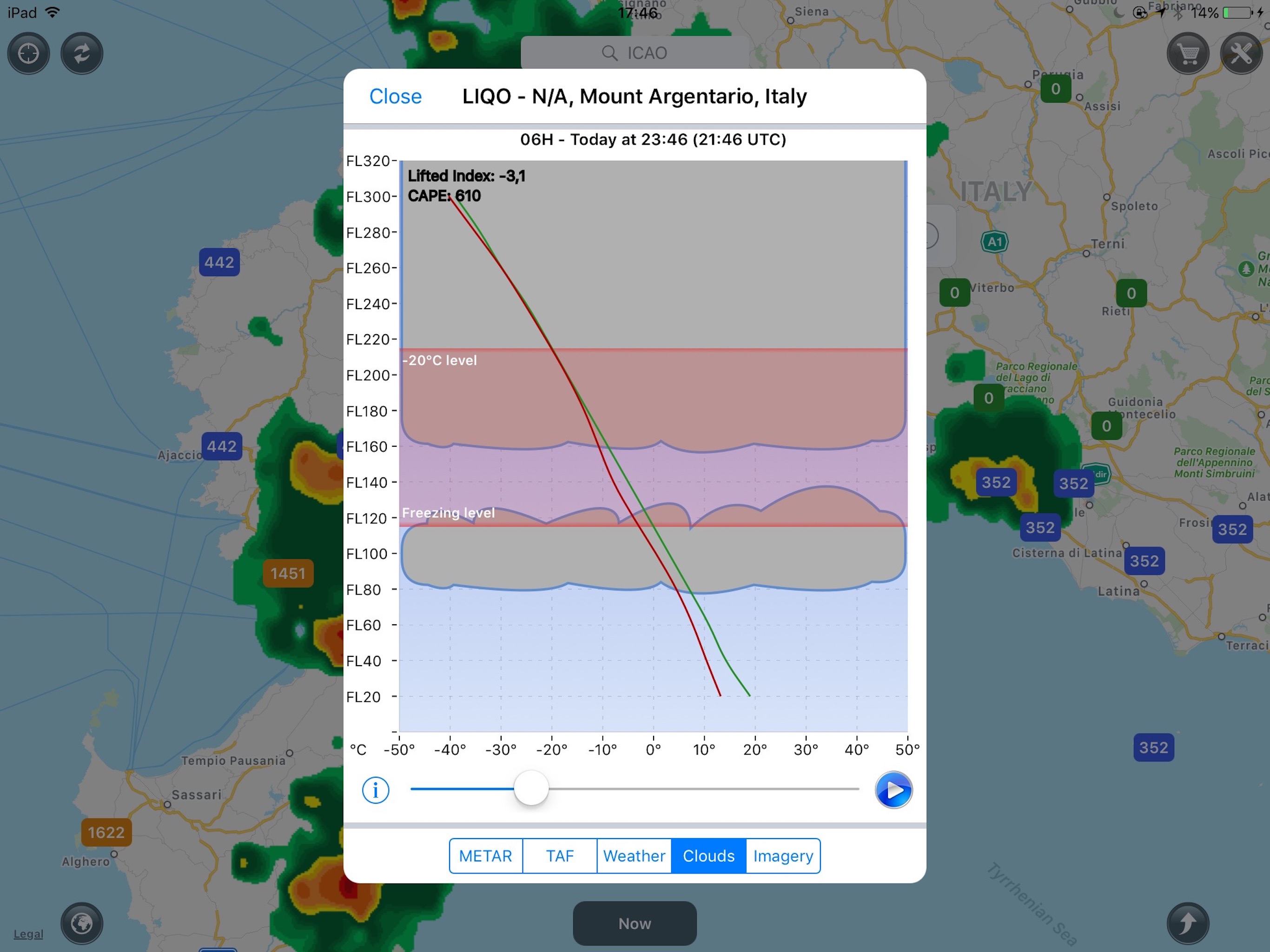
The above clouds diagrams show the forecasted cloud layers, freezing level and -20 degrees Celsius level, all based on weather model data. The dark colour of the clouds indicates a higher probability for thunderstorms and convective clouds based. You can play the forecast forward in time to see how the weather could potentially develop over time. This information is of value as this airport does not produce a TAF forecast.
Winds Aloft and Dynamic Isogonic Lines
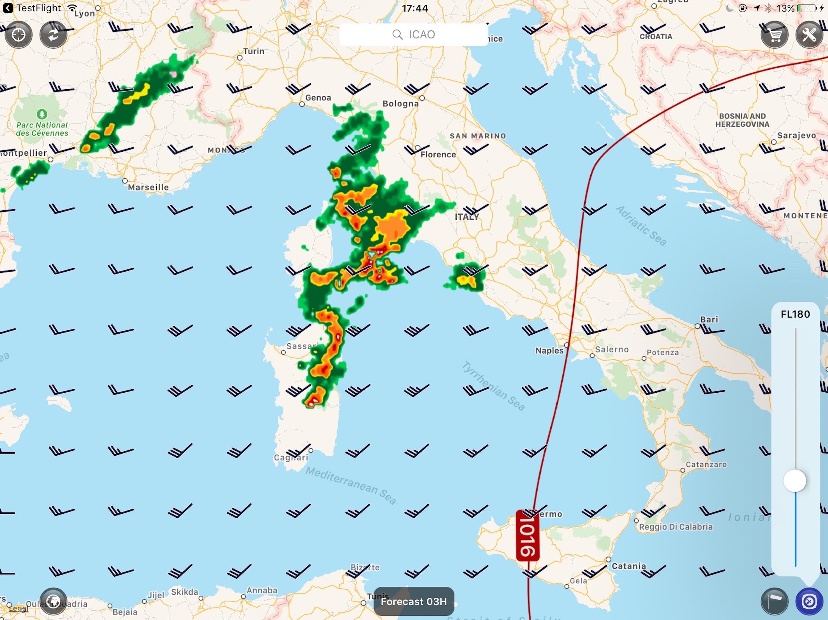
The Weather app also gives you information on the winds aloft at altitude and can draw dynamic pressure charts for a current and future situation. The information comes from numerical weather models, so would be something you most likely do when preparing for you flight or while still on the ground.
Actual, Model-based and Delayed Weather Info
Some of the weather data you received is based on actual observations. For example, METAR data for an airport is based on actual (system) observation and measurements. However, this data is not released every minute, so have a look at the timestamp of the METAR weather you receive over your satellite link and think about the type of data you receive. Is it actual weather or a forecast and is this prediction made by a forecaster (TAF) or based on a numerical weather model. Rain Radar data is based on real weather. However, the radar image is delayed. The delay could be 10-20 minutes. Don’t use the rain radar image for strategic weather penetration purposes. Download, several rain radar overlays over a period, to see how the weather is moving. TAF and weather model data is based on local weather knowledge combined with weather model data. In the case of TAF forecasts, a local weather forecaster will predict the weather for you. In other situations, you are getting the raw data of the weather model. Be aware that this weather model is model data and not an actual observation.
Rain Radar data is the actual weather. However, the radar information is old information by the time it is displayed on your iPhone or iPad in the cockpit. The delay could be as much as 10-20 minutes. Don’t use the rain radar image for strategic weather penetration purposes. Fly around the area. Don’t go and push it. Our app and the rain radar data are not meant to be used for that purpose. For that, you would need to add an airborne radar system on top of our satellite-based rain radar solution.
Lightning data offered by our app** is actual data and is displayed on your iPhone or iPad screen with hardly any delay. Still, don’t use it to penetrate severe weather. Use the extra information to stay away from thunderstorm activities.
Be aware that numerical weather model data is not giving you weather data that is observed. It is based on a theoretical model.
Lightning Data
We provide lightning data worldwide** . For example, all of Africa and even oceans are covered, and the strike data is provided in near real-time. There is a one to two minutes delay to deliver you the strike data through the satellite link and for processing the data. Next to cloud-to-ground lightning, we also support in-cloud lightning.
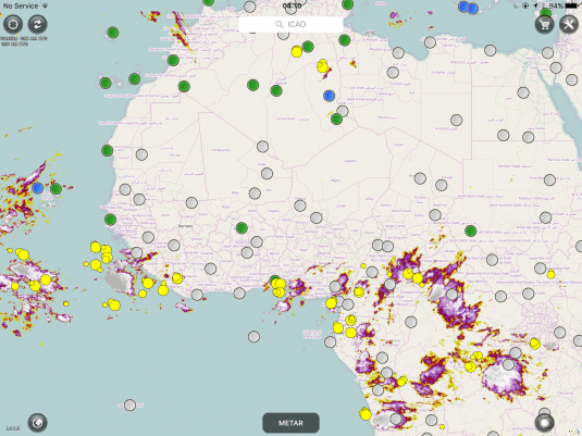
The above image shows lightning areas in West Africa. There is no rain radar available in Africa as there are no doppler radar stations there to be found.
Augmented Radar
The augmented radar option in our app shows the rain radar, where available, next to the cloud tops as is visible in the above image. The cloud top data comes from satellite data, while the rain radar is provided through doppler radar stations. Together with the near realtime lightning data, it gives you a pretty good idea of where to expect severe weather and thunderstorms.
Dangerous Thunderstorm Alerts (DTAs)
We teamed up with Earth Networks where they provide us with lightning data as well as dangerous thunderstorm alerts. Their lightning detectors detect cloud to ground lightning as well as in-cloud strikes.
** Lightning data is available about everywhere in the world except for very remote areas such as at the poles, the southern part of South America, most of Russia (except the Vladivostok area) and several other areas.
Coverage Area
The airport data such as METAR and TAF as well as the numerical GFS weather model data is available worldwide.
The rain radar is provided for North America, Central America, Europe, Australia and parts of the Pacific. In North America, the lower part of Canada is still covered including the State of Alaska. However, there is no rain radar coverage in the northern part of Canada. Greenland and Iceland are not included in the coverage area. Central America is covered including the Caribbean area. All of Western Europe is covered except for a small portion near the Mediterranean sea in the South of France and off the coast over oceans and seas. If you do fly there, use the augmented radar feature and make sure you download the lightning strikes for the area.
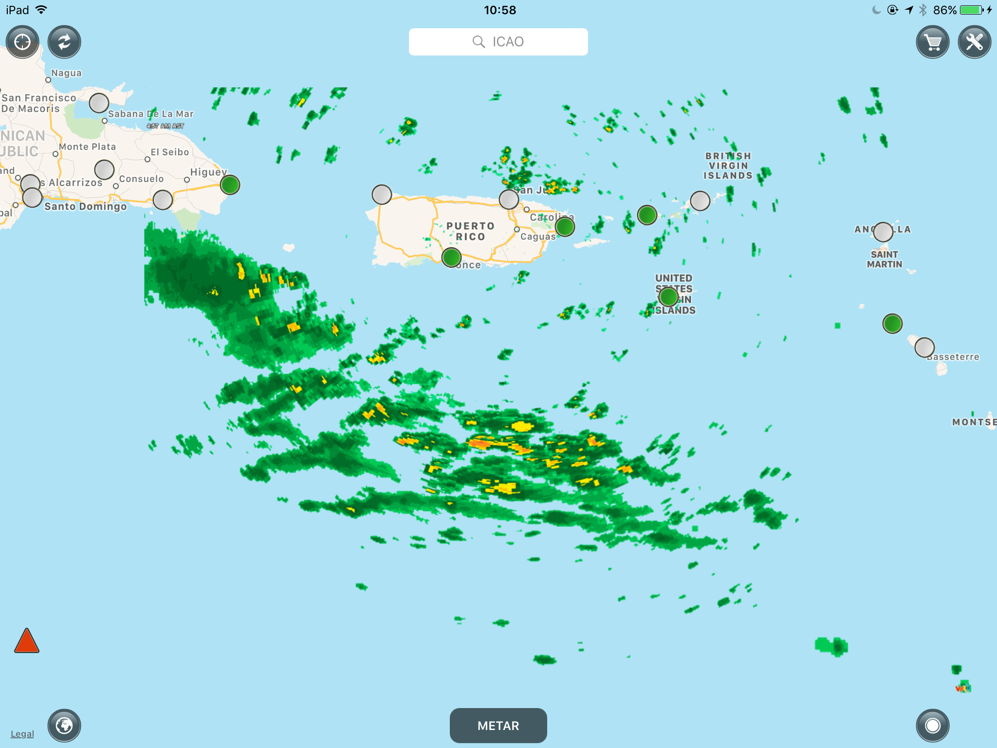
The above image is a part of the Caribbean area. The orange triangle is the SIGMET warning for the area, due to a major storm taking place at the moment this screenshot was taken.
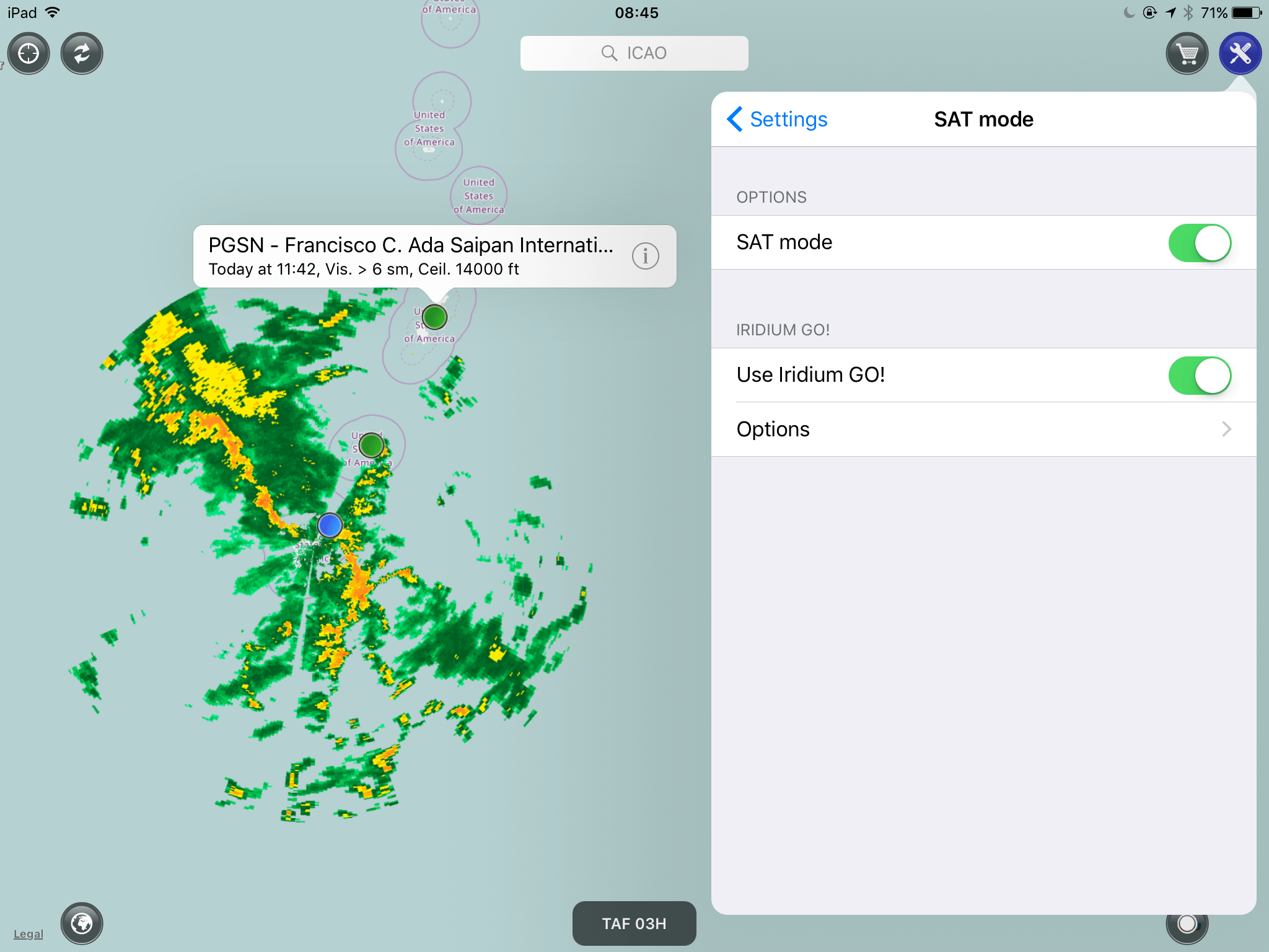
Above screenshot is from Saipan Island, which is a part of the Northern Mariana Islands.
External Antenna
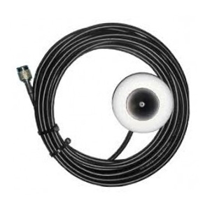
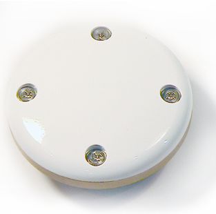
The Iridium GO! can be used without any external antenna or connected to an external antenna. The external roof antenna is available as approved component under FAA or EASA rules (minor mod). However, it might not be necessary to install an external antenna at all. There is also an external antenna for use inside the aircraft with a suction cup for which no approval or certification is required. It is called the Iridium Aviation Glass Mount Antenna and specially made for aviation purposes. The external plane roof antenna, which is known as the Iridium Aviation External Patch Antenna, can be bought through your aircraft avionics provider.
Web-based Configuration Tool
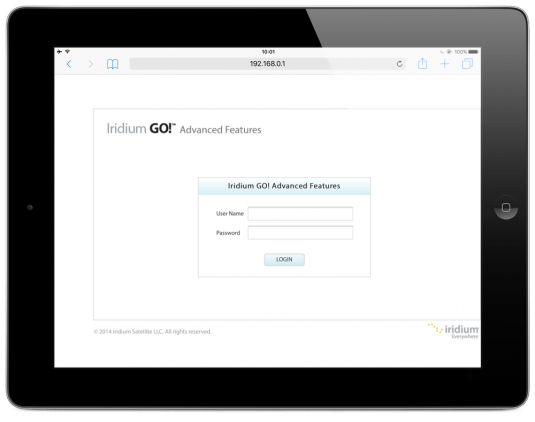
You can easily configure the Iridium GO! using apps from Iridium for iOS or Android. There is also a web-based configuration tool build into the Iridium Go! The device creates a WiFi network and with any computer or tablet you can connect to it with your web browser to configure it, create user accounts, etc.
GEOS Rescue Service
The Iridium GO! includes a subscription for the worldwide GEOS rescue service. With some of the other options, this comes at a premium or is not an option at all. You can alert GEOS or set your alarm addresses using the web configuration tool.
Piece of Mind
The fact that I can make a phone call from any place on earth and get the latest weather to my cockpit independent of where I am flying gives me a piece of mind. I don’t have to call or retrieve weather data, but the fact that I have this option is great.
Iridium GO! Device Price
We don’t sell the Iridium GO! device or Iridium Data Plans. Search around. You should be able to get the Iridium GO! device for around $680.
Iridium GO! Data Plans
Iridium offers prepaid cards valid for 12 months and giving you 1000 data minutes (GO! 1000 & 1 Year)
Purchase price: 550.00 – 600,00 euro ex VAT;
Which is about: 50,00 euro per month ex VAT.
What you get:
- 1000 data minutes per year;
- Outgoing voice calls are charged at twice the data minute rate, so a 5-minutes call is charged as 10 data minutes;
- Free incoming voice calls;
- Free incoming SMS messages;
- Short SMS/Text/E-mail send out with the Iridium Go! app are charged at 1/3 of the data minute rate.
- Free GEOS rescue subscription (comes with the Iridium GO! device).
AeroPlus Weather App Subscription Plans
The AeroPlus Weather app is offered at a subscription price through the Apple Appstore
- 12-month subscription for 49,99 euro
- 3-month seasonal subscription for 19,99 euro
Download our aviation weather app from the Apple AppStore here.
For more information on the Iridium Go! check out their website: www.iridiumgo.com.
Read this review article about Iridium Go! in Plane & Pilot Magazine.
*The data speed of the satellite network is at a 2400 baud data rate – about 20 times slower than the old dial-up modem 56K rate. Who can remember that time when we had to use a dial-up connection with a modem to connect to the Internet? A 50 KB file could take 4-7 minutes or longer to download over an Iridium data connection. Where you theoretically get 2400 baud with 5 bars Iridium signal, you will only get a speed of about 1200 baud if you have 4 bars of signal. With 2 bars, only about 10% of the speed remains. Iridium, however, is launching new satellites into orbit to deal with this limitation and over time, the Iridium network will become faster. Aviation weather like METAR, TAF and GFS model data can be downloaded in most cases in between 30 seconds and 2 minutes. A rain radar overlay will download in between 2-5 minutes.
Frequently Asked Questions
[faq group=datalink-weather]

