Book Companion Section
Table of Contents
Bookmark this Page!
Start by bookmarking this page by pressing Press Ctrl + D. That way, you can go back to it at any time in the future. I am also sending you a confirmation e-mail message that confirms your subscription to this page. Keep that message as it will include the URL link as well. This section of my website is hidden and not listed anywhere. Therefore, make sure you save the URL to this page! Press Ctrl + D will do the job.
Crossing Oceans
This list of telephone numbers is one to bring along on flights across oceans. You can call these phone numbers from your SAT phone to talk with the specific station, e.g. if your HF radio does not seem to work very well. Please double check the phone numbers before depending on them. If you have corrections or additions, I would like to hear from you so that I can update the list.
[table]
Station Name, Phone Number
Gander Radio,+1 709 651 5328
Iceland Radio,+354 553 3022
Brisbane Center,+61 7 3866 3314
Melbourne Center,+61 3 9235 7492
Nadi (Fiji) Radio,+679 672 0664
Auckland Radio,+649 275 9817
Faleolo (Samoa) Center,+685 12530
Oakland Center (from PCHL to PHNL),+1 510 745 3403
Oakland Center (Hawaii),+1 510 745 3415
San Francisco ARINC,+1 925 371 3920
For ramp access at Maui (PHOG),+1 808 872 3875
Punta Arenas ATC,+56 61 745474
Punta Arenas Operations Office,+56 61 745417
Punta Arenas Meteo (weather),+56 61 745467
[/table]
Tip 1: Start by putting your SAT phone number in the “Other Information” section of your flight plans, so that ATC can call you in the plane. ATC might also ask you for your SAT phone number.
Tip 2: Harry Anderson has written the excellent Kindle eBook ‘Flying 7 Continents Solo.’ It is a valuable source of information for those planning to fly around the world. Harry allowed me to copy the above phone numbers for your use regarding his book as the source. I think I read his book at least twice!
Tip 3: Don’t forget to use the eAPIS notification system when you plan to fly into or out of the US with your plane. The US requires all aircraft to file a flight manifest when entering of leaving the US. Check out the eAPIS FAQ section on the AOPA website as well. Also, we aware the Visa Waiver Program (VWP) does not apply to private flights, so if you plan on flying your aircraft to the US, you will need to apply for a normal B-1 (business) or B-2 (tourism) visa.
Tip 4: North-Atlantic routes: if you plan to fly above 5.500 feet altitude, you need to file an IFR flight plan. It is very unlikely that you will be able to cross the Atlantic remaining in VMC conditions all the time.
Tip 5: You might need to install HF radio. Especially on the flights to and from Hawaii, you won’t be able to get approval for your flight anymore without a working HF radio installation installed in your aircraft. On almost all of the North-Atlantic routes, HF radio is also mandatory now. There is still one left that does not require aircraft to be equipped with HF radio equipment, but double check before you go. If you plan your route above FL250, you might be exempt from the HF radio requirement. HF radio is not as reliable as VHF radio, but VHF does not provide the range that is needed when crossing oceans. If your HF radio connection is not working all too well, you could alternatively give ATC a call with your SAT phone.
Tip 6: For those planning a flight around the world, have a look at the Earthrounders website.
Tip 7: When you cross oceans, there usually is no radar coverage, so ATC depends on you giving position reports. If you can’t get ATC on your HF radio, call them with your SAT phone or delay a message through the air-to-air frequency 123.45 MHz. Planes flying higher over the ocean often use this frequency to communicate with other aircraft.
Tip 8: If you have the choice between installing the Garmin GNS530W or the SL-30 NAV/COM, several Earthrounders have reported that the SL-30 proves to be the better radio.
Tip 9: Check out the www.220kt.com website for more information on Trans-Atlantic ferry routes.
Tip 10: Consult the North Atlantic International General Aviation (IGA) Operations Manual published by ICAO. It will cover basically what you need to know. You can download a version from here: [download id=”46722″]
Two Popular North-Atlantic Routes
There are several known routes to cross the North Atlantic from North America to Europe. The first of the two most commonly used routes begins in Goose Bay, Canada, then goes to Narsarsuaq in Greenland, then on to Reykjavik, Iceland and finally to Wick in Scotland. The longest flight leg on this route is about 680 NM. The second of the two most popular routes goes from Iqaluit in Canada to Sondre Stromfjord or Nuuk in Greenland, then onwards to Kulusuk, also in Greenland, then to Reykjavik, then to Vágar, Faroe Islands and finally the last flight going to Wick in the UK. If you opt for this route, then the longest leg is about 490 NM.
Instead of buying a professional immersion suit, I bought a drysuit at a sailing web shop called Sail Supply for about 400 euro. They breathe well and are tailor made to fit your size. Bring a dry suit for all passengers and crew on board. I also wear a life-vest and bring along a life raft. Each person on board carries his personal locator beacon (PLB) already attached to his life vest. In my opinion, it only makes sense to wear it all and not to carry it along as luggage in the aircraft. The drysuits coming from the sailing shop are comfortable to wear for longer times if you get them tailor made. However, be aware that on some oceanic routes the equipment has to be certified, so the sailing dry suit might not be legal.
Satellite Communication
I previously wrote a couple of blog posts on the use of satellite equipment:
- Satellite tracking blog post: http://www.aeroplus.nl/fly/wnlc1
- Aviation Satellite Weather in the Cockpit: http://www.aeroplus.nl/fly/o4cdb
- Aviation Weather on the Go: http://www.aeroplus.nl/fly/juuk9
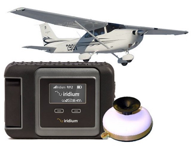
Delorme Inreach 2-way Satellite Communicator
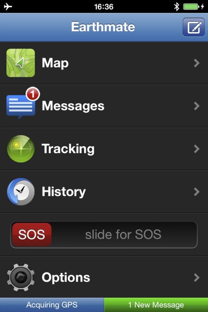
I love this Inreach device. I have the old one shown below, which I stick to a window with an RAM-mount specifically designed for this device. It runs for a week on 2 Lithium batteries if you use it only during your flights. I can get textual weather data, the device tracks my flights and records my block and flying times. Friends and family can follow along on a map where the aircraft position is shown with its ground speed and altitude. They can even click on the icon and send me a message.
Advantages:
- Cheap and simple to use solution with a low subscription fee per month.
- If you update your Delorme account to an Enterprise account, you can increase the tracking rate to refresh every 5 minutes. If on an Enterprise account, the device integrates well with the AeroPlus Flightplan app for keeping track of flight data.
- App for smartphone allows for 2-way text message communication.
- Weather data such as METAR, TAF, and GFS data is available and provided “as is” and delivered through text messages.
Disadvantage:
- No rain radar map, only 2-way text messaging and position tracking data is exchanged over the otherwise slow Iridium network. The speed is no issue with text messages.
- No voice calls can be made.
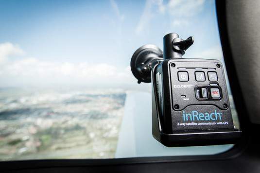
Delorme Inreach 2-way communicator.
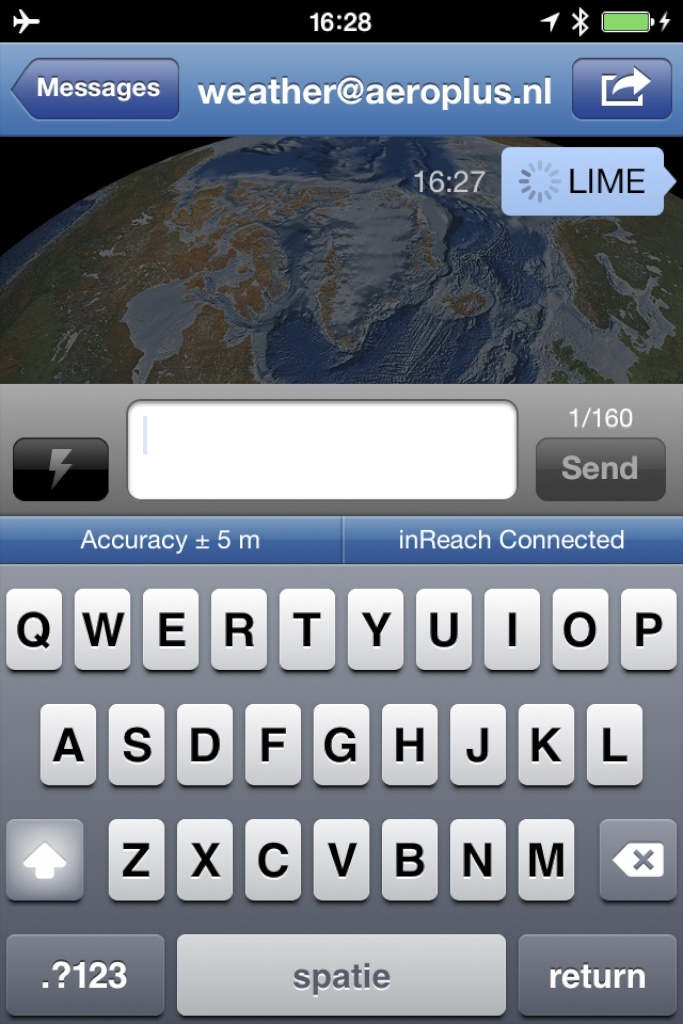
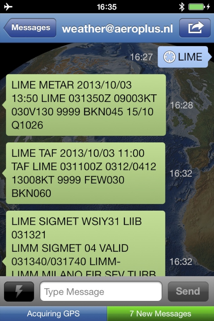
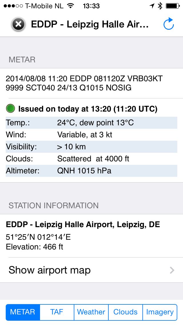
The inReach app for your smartphone is called Earthmate and is available for both iOS as well as Android devices. In the screenshots below, I have sent a text message to weather@aeroplus.nl with as only content the ICAO code of the airport for which I am requesting the latest weather. In this case, the ICAO code is LIME. LIME is Bergamo Airport in Italy or officially Aeroporto Internazionale Il Caravaggio. As a result, I receive several short text messages through the satellite network with the METAR, TAF, SIGMET and GFS Model-based weather data for this airport. The response comes in after a few minutes.
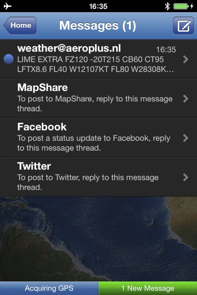
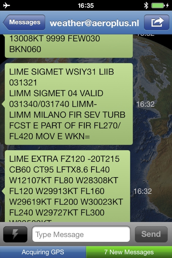
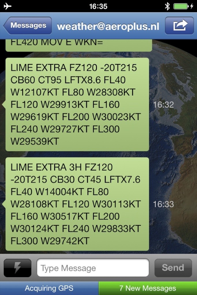
After requesting the data, a few minutes later I receive several text messages with the latest METAR, TAF, and SIGMET for the Bergamo Airport and its surrounding area. The reason that I receive several messages is the limitation of the length of text messages I can receive through the satellite link and Earthmate app.
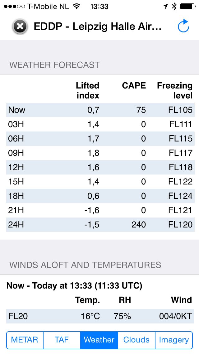
The EXTRA information contains the freezing level (FZ), the flight level at which it is -20 degrees Celsius (-20T), where to expect the top-of-clouds (CT), the Lifted Index value (LFTX), and the winds aloft at different flight levels. The EXTRA 3H provides the same information, but then for 3 hours ahead.
The weather data is provided “as is” for free to anyone having an Inreach device. It is not an officially supported feature that we as AeroPlus Aviation or Delorme offers.
Golze Engineering ADL devices
Sebastian Golze has designed his ADL devices to provide In-Cockpit-Weather. You can find information on his website here. If you fly only within Europe, this is a great solution. The ADL devices work on the Iridium satellite network. METAR and TAF data, as well as aircraft tracking, is available worldwide.
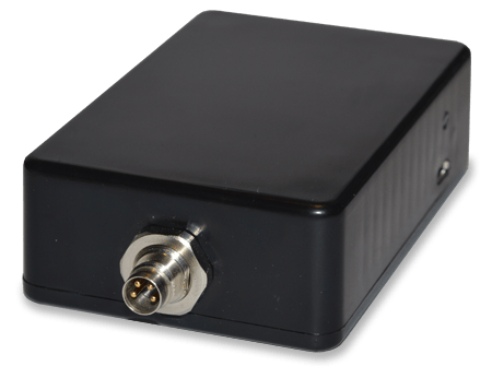
Golze Engineering ADL 140 device.
Advantages:
- Relatively cheap satellite-based rain radar device.
- Free aircraft tracking data provided.
- Weather data such as METAR and TAF is given.
- Comes with a free app for iOS only (iPhone|iPad).
- With the app, you can send SMS messages over the Iridium network.
- Integrates well with the AeroPlus Flightplan app for keeping track of flight data.
Disadvantages:
- Rain Radar images are only available in Europe. There is no coverage outside of Europe.
- You need a separate weather subscription with the German weather service DWD, again covering only Europe.
- You cannot make voice calls with the ADL devices.
Iridium Go!
The Iridium satellite network is available from pole to pole. However, the data speed is very slow at 2400 baud compared to 64 kbps with a Thuraya satellite data link. A 1 MB image would take more than 5 minutes to download over an Iridium data connection. Iridium is launching new satellites into orbit to deal with this limitation and over time, it will become faster.
Iridium Go with window suction cup antenna.
Don’t expect to be able to download lots of stuff from the Internet easily when you have this device. However, you can make voice calls and use some special apps to send and receive text messages. When making calls you can link a Bose A20 or some other brands of headsets to your iPhone and use that to make the call over the headset utilizing the noise canceling feature of the headset. Works pretty cool. Here is a review of Iridium Go used in the cockpit.
Iridium Go product website: https://www.iridium.com/products/details/iridiumgo
Advantages:
- Worldwide coverage from pole to pole.
- No external roof antenna needed.
- Text messages up to 1000 characters long are possible.
- Calling from multiple connected phones (up to 5) in aircraft to any ground-based phone numbers is possible.
Disadvantages:
- The Iridium data network is slower than e.g. the Thuraya network, but then again, you have worldwide coverage and don’t need an external antenna.
- At the moment there is no aviation weather radar application available that supports the Iridium Go, but that might change soon. There is an application called FlyCast that is certified to work with Iridium Go! We are also working ourselves on an Iridium Go! compliant version of the AeroPlus Aviation Weather app for iOS.
P.S. We are currently in the certification phase with Iridium and will be ready to launch a version of our weather app for the Iridium Go device. Stay tuned!
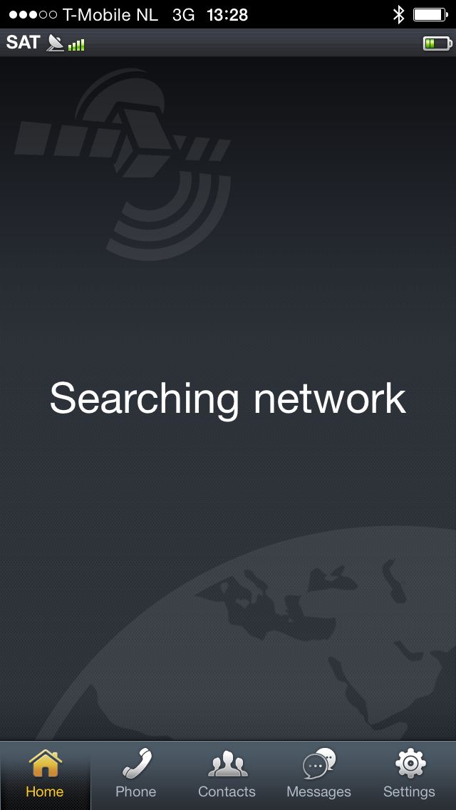
Thuraya Satsleeve
The Thuraya satellite network consists of two stationary and functioning satellites both positioned near the equator. The coverage area includes most of Europe, Africa, Asia, the Middle East and Australia, but does not cover the pole regions, North America, South America and the southern part of Africa.
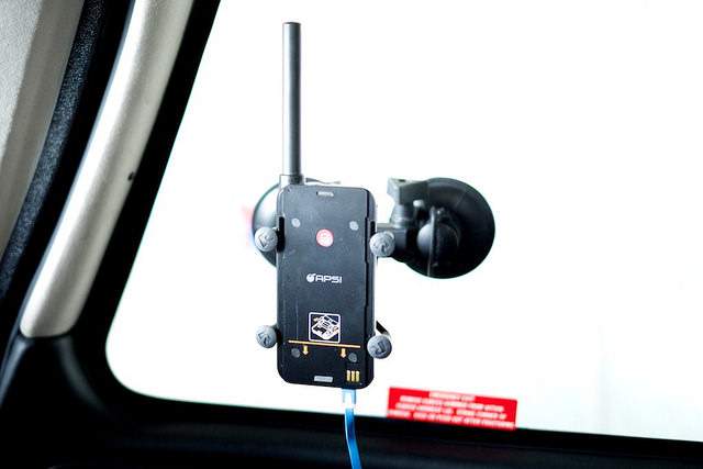
Thuraya Satsleeve mounted to the side window of the Cirrus. The blue cable is a 12V power cable.
Advantages:
- Relatively fast data network at speeds up to 64 kbps.
- No subscription needed for Thuraya phone sim card. Prepaid options.
- Weather data available with rain radar through the Aeroplus Aviation Weather app (beta, ask me if interested)
- Text messages are supported next to voice calls (however, not through a Bose A20 headset!)
- When properly installed with an external antenna, it provides a good data connection that can bring you the weather imagery much faster than through the Iridium network.
Disadvantages:
- For Thuraya to work well, you need to mount an external antenna on the roof of your aircraft.
- No worldwide coverage: the poles, North America, South America, the southern part of Africa not covered.
- Making voice calls through the Bose A20 headset does not work, even if the headset supports Bluetooth.
Weather Images delivered through Thuraya Network
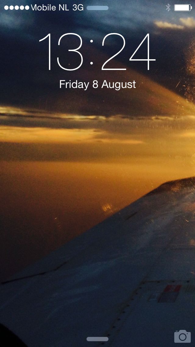
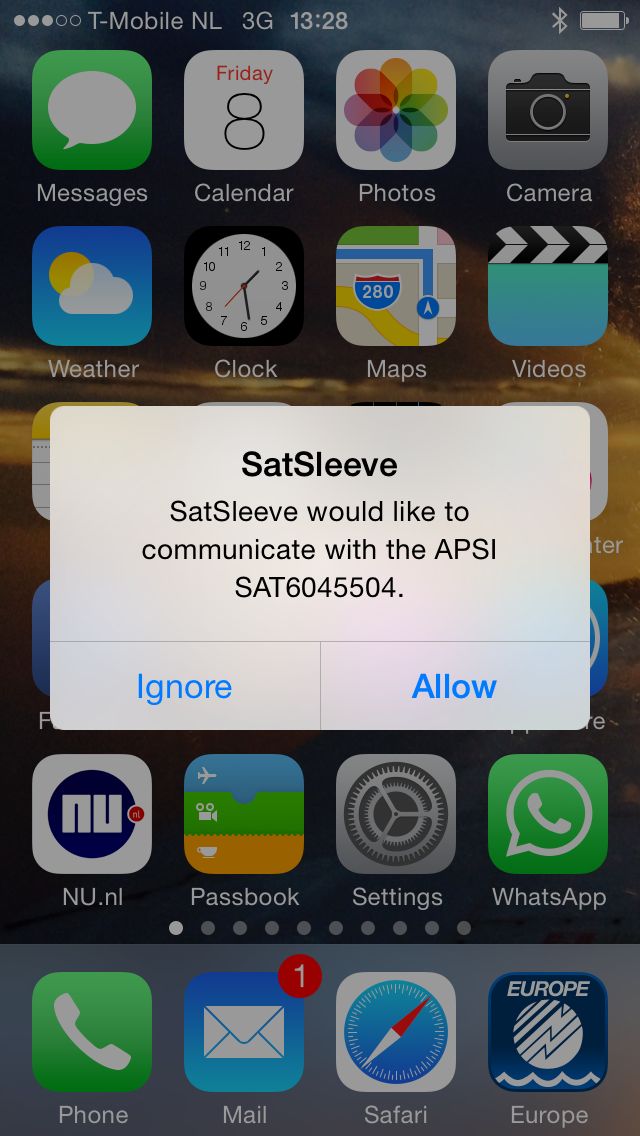
While still in 3G coverage, I connected my iPhone to the Thuraya Satsleeve to set up a Thuraya satellite network. The Satsleeve does not have to be connected physically to the iPhone. You can connect with it through Bluetooth. That connection will allow you to make voice calls over the Thuraya network using your iPhone and its designated Thuraya phone app.

One you are locked into one of the Thuraya network cells, you can initiate a Satellite Data connection, which is made available on WIFI. You can connect only one device over WIFI to the Thuraya Satsleeve. That can be your iPhone, but could also be another device such as your iPad or an Android tablet. You can, for example, use your iPhone for voice calling using the Bluetooth connection to the Satsleeve and at the same time connect your iPad over WIFI to the same device.
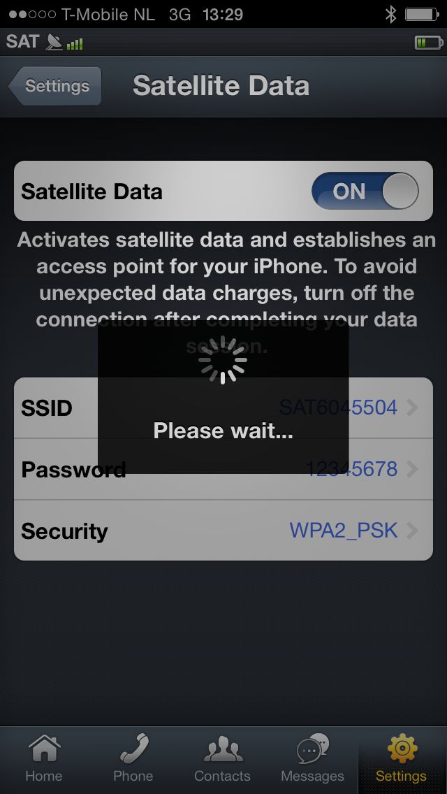
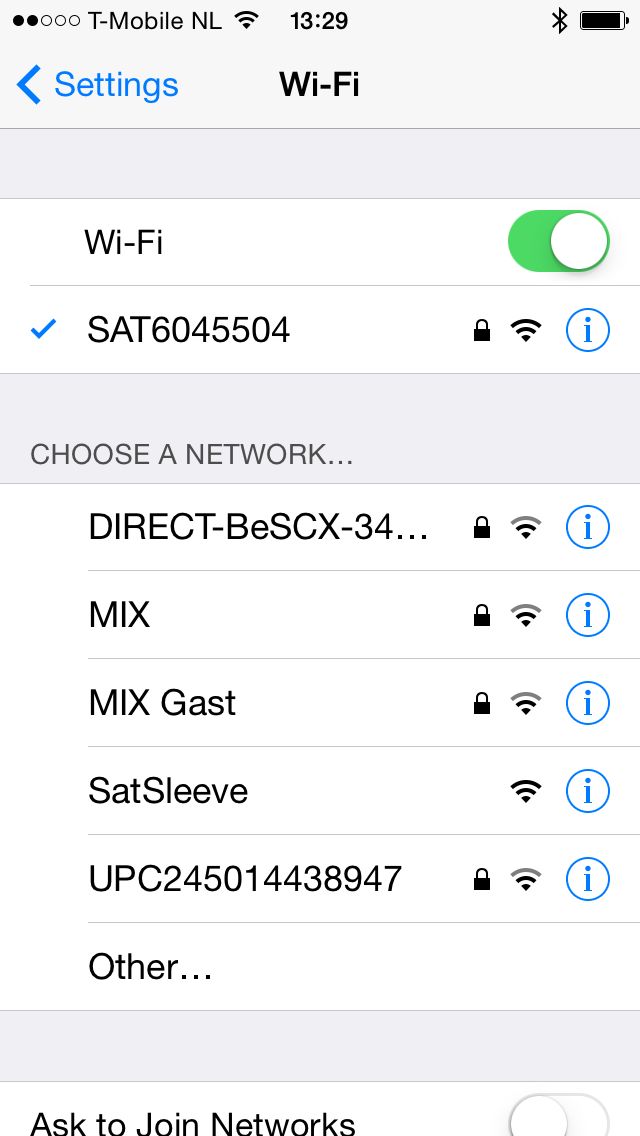
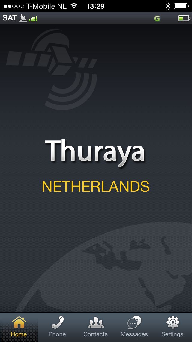
After setting up the data connection, you will see that the SAT data link is up on the next left screenshot below. I then use the AeroPlus Aviation Flightplan App to prepare or file a flight plan for the next flight or use the AeroPlus Aviation Weather app to check the latest weather.
Below some screenshots of the AeroPlus Aviation Weather app in SAT mode. In SAT mode the background map is limited and not downloaded anymore. I can request the latest rain radar data or the weather for a specific airport. In this case, I requested the latest weather for Leipzig (EDDP) and a rain radar image while still in The Netherlands.
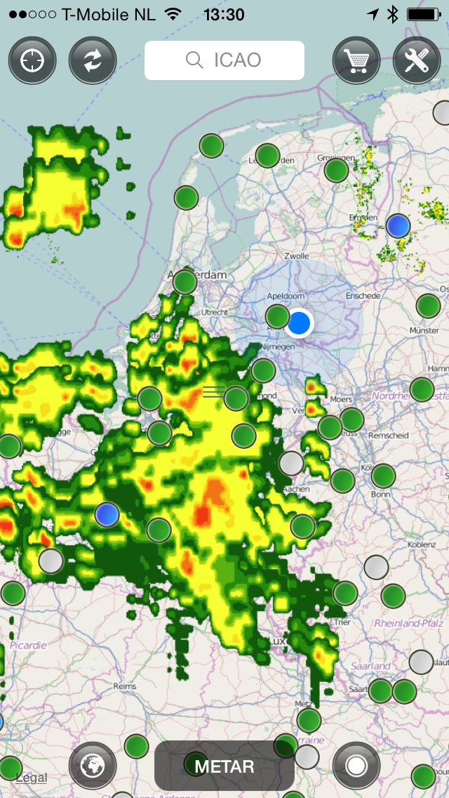
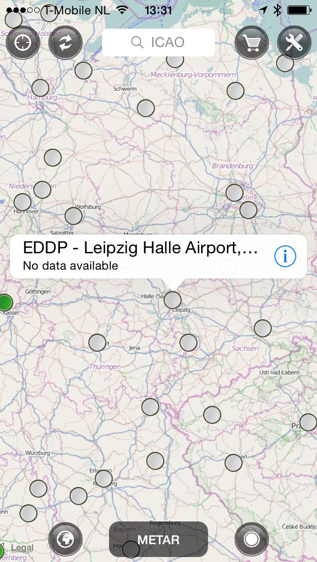
After waiting less than a minute (see the time stamp) the weather is delivered to my iPhone through the Thuraya satellite network.
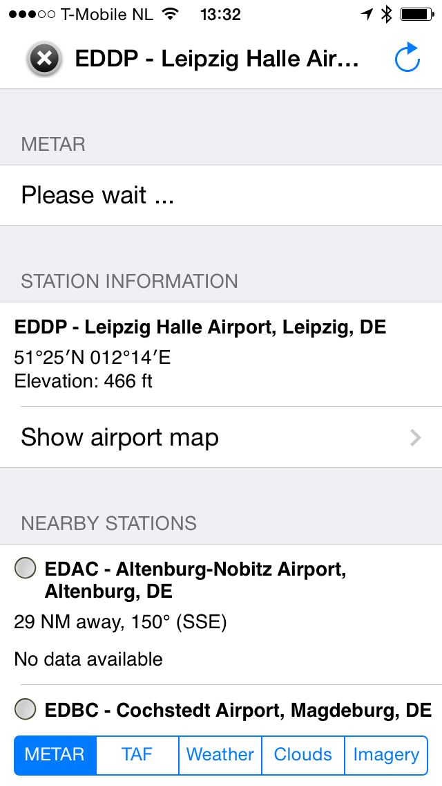
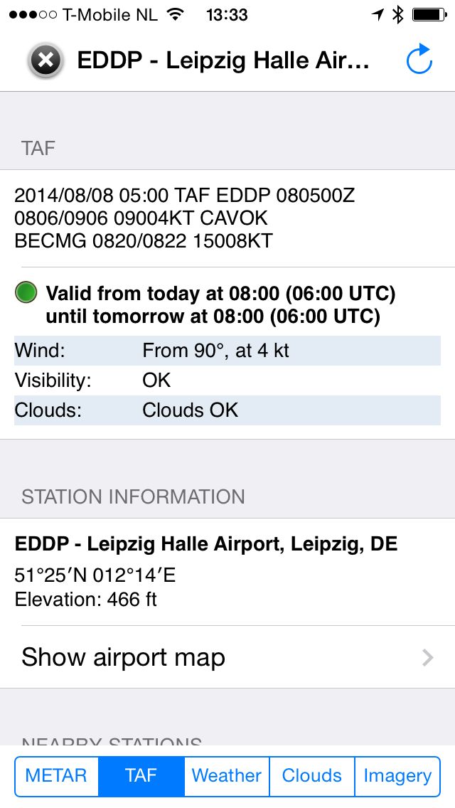
TAF and GFS weather model data is also provided at the same time.
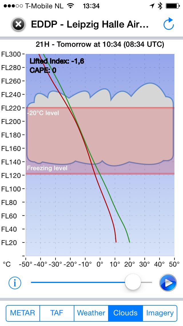
The clouds diagram is delivered through the satellite network as well. A clouds diagram is a simplified GRAMET. It is a vertical profile of the atmosphere at one particular location. In this case, the clouds diagram is requested for Leipzig.
Downloading satellite images over a satellite link could take quite a long time if the highly compressed images were sent over the Iridium network. When using the Thuraya data network, the images are downloaded in less than a minute.
Winter Flying
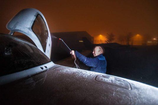
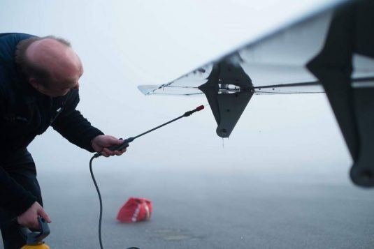
In winter time your aircraft might have a layer of frost or ice on the wings when you get to it early in the morning. I bring along a standard gardening spray bottle and fill it up with TKS fluid. Use the gardening spray to spray TKS fluid on the wings and the ice will come loose instantly. After that, use a cloth to wipe the wings clean.
FIKI
Consider flying with an aircraft that is FIKI equipped in the winter. FIKI = flight into known icing. Having an instrument rating will help as well. With both an instrument rating and an FIKI aircraft, there is a better opportunity of passing through winter weather en route to your next destination.
For more information about flying in snow or winter conditions, read my blog post here.
Supplemental Oxygen
Being able to fly high can make the difference of having to fly through the weather or being able to fly above it. I wrote a blog post about flying on supplemental oxygen, which might be of interest to you. You can find it here.

Conflict Areas
Some of this information is also included in a second edition of the book. I am including it here with some extra pictures and with some information that I could not easily include in the book. It is a sensitive subject. Why would you go and fly through a war zone? Sometimes you just don’t have a choice but to pass through a conflict area to get from one place to the next.
The first time I prepared myself for a flight through Mali, South Sudan, and Yemen, I just wondered how safe it would be. Would rebels shoot at me with their AK47 rifles if I would fly over their camps? I simply had no clue and could not figure it out initially. After all, I don’t have a lot of friends that fly a lot in such areas. Just to make sure, I don’t want to fly specifically through any conflict area. However, sometimes I do not have a lot of alternatives other than to fly through. In any case, I don’t have definitive answers on how safe it is, even though I do by now have some experience flying through such areas. I am writing you about my personal experience. You should make up your own mind, based on the information you can get and in relation to your specific situation. Sometimes it might just be better to stay home.
AK47 Rifles
Is there a risk of rebels shooting their AK47 rifles at me when flying over. Technically speaking, this might be possible, but as far as I understand it, it is very unlikely to happen if you fly 8000 feet or above over conflict areas. If rebels are known to be grouped around major cities and you happen to fly to that city, then consider flying into that airport at or above 8000 feet altitude, to then circle overhead the airport before descending from overhead to the runway below. Best is to ask around before you go into such areas. Make sure your insurance company covers you. I have had no problems getting the aircraft insured, even for flights going into Damascus, Syria, Yemen, Mali or South Sudan in troubled times for these areas.
Juba, South Sudan
When flying to Juba, South Sudan, we had already been informed that they had tanks installed next to the runway to protect the airport from intruders. I understood that other aircraft from MAF and relief organizations such as Flying Doctors were flying into Juba daily with no problems encountered. So, based on this information, which I received from a pilot flying into Juba several times a week, I decided to go. We had a great time in Mozambique with our friends and did not encounter any problems.
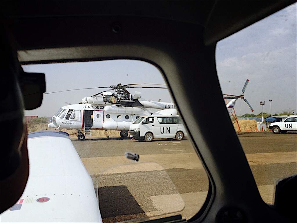
Lots of military and UN aircraft spotted at the airport after we landed there.
We did not have a lot of other options, as we had to move up north one way or the other from Uganda. Going through the Central African Republic was not a good choice as that was considered not safe at the time. A route from Uganda via Juba to Khartoum seemed the best option to us for getting into Egypt.
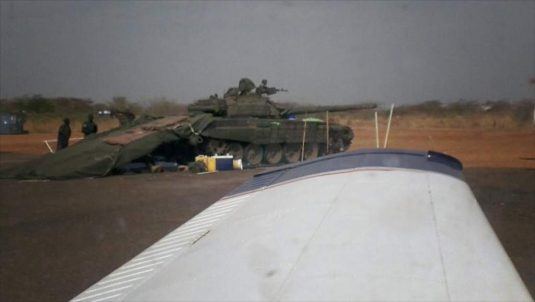
Tank positioned near to the holding point for the runway, Juba Airport.
Child Soldiers with Rocket Launchers
After landing at Juba Airport, we ran into a pickup truck with child soldiers sitting in the back, some of them carrying rocket launchers. They were there to protect the airport from rebels surrounding the city. The handler driving us from the airport to our hotel pulled over to the side instantly as this pickup truck approached us. His hands started to shake. He did not like them as they could just start shooting without any warning, he said. I am glad they left us alone.
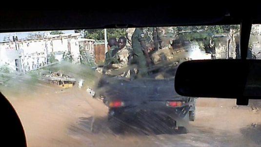
Child soldiers were armed with rocket launchers.
We could not leave the hotel that night in Juba to go out for dinner in the city. It was just too dangerous. Once we crossed the border between South Sudan and Ethiopia, I felt relieved not to be in this conflict area anymore.
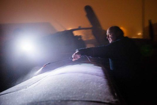
Aden, Yemen
We failed to get the needed permit to fly from Juba through the northern part of South Sudan to Khartoum. Later on, we found out that a massacre had been going on that night in Malakal. Malakal is a city in the north of South Sudan. We had to change plans and decided to fly to Ethiopia instead. By flying into Ethiopian airspace, a route through Eritrean airspace towards Egypt was not an option anymore. Eritrea and Ethiopia are not best friends, and once you fly into Ethiopia, you are no longer welcome in Eritrea. We continued to fly from Ethiopia through Djibouti to Aden, Yemen. The idea was that we would then be able to continue our flight from Aden through Yemen and Saudi Arabia to Egypt.
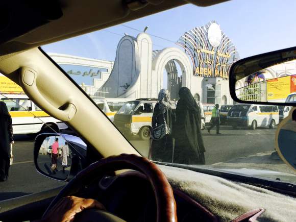
The Aden shopping mall.
The city of Aden was at the time of our arrival already surrounded by Al Qaida rebels. We found road blocks everywhere in the city as well as on the road to the airport.
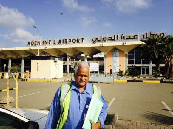
I took the above picture of our handler in 2014 in front of the Aden Int’l Airport building. A year later, the airport was seized by rebels in a conflict that is still going on more or less in Yemen. The presidential B737 was destroyed while it was parked on the apron of the same airport.

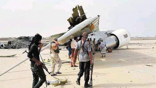
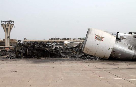
Behind the remains of the presidential aircraft, you can see the signs of the main terminal building of Aden Airport. Below, you see our aircraft parked on the same apron a year earlier.
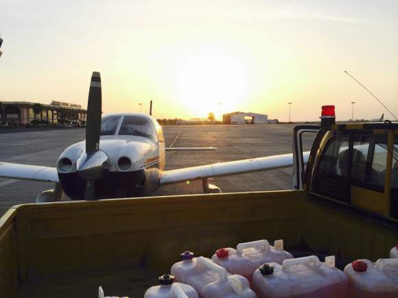
Our Piper Archer parked on the same apron, Aden, Yemen.
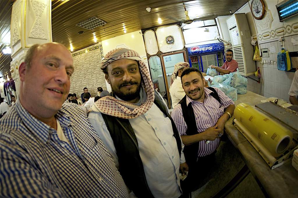
Making new friends in a local restaurant in Aden, Yemen..
Mozambique
Reading through the travel advisory of the Ministry of Foreign Affairs of The Netherlands website on their travel advise for Mozambique, the risk of kidnapping is mentioned. Talking to the expats that we were going to visit and that live in Maputo, Mozambique, they said that this was a risk up to a year ago, but that there had not been any kidnappings ever since, and the problem seemed to have been resolved. Also, we were flying with a Cirrus from Kruger International Airport to Maputo and later up north to Vilanculos (Vilankulo) where our friends had a summer house. They said that they have been going to Mozambique for at least ten years and that this area was safe. So, based on the above information we decided to go.
To conclude: sometimes you have no choice but to overfly and land somewhere that is not on top of your shortlist of nice places to visit. Ask around before you depart if it is safe. Call the handler and airport staff at your destination airport. Ask the staff at your departure airport if they know about pilots still flying regularly to your next destination. Ask around how safe it is. Then make up your mind considering the options you have. Stay safe!
VFR Addressing 2.0
When you fly into Africa, Asia or South America, the addressing of your flight plan can become an issue. Not all providers of flight plan filing software can deliver the flight plan to the correct addresses. Read here what this is all about and why it is important.
Let’s Connect!
If you have any plans to make an adventurous flying trip, I would love to hear from you. Send me any questions and comments you might have through the form below and I will get back to you as soon as possible, hopefully of course with some answers.
Overland- and Landing Clearance, Fuel or Handling Request Form
Requesting support in getting overland- and landing clearances worldwide with a specialty in arranging clearances for the African continent.