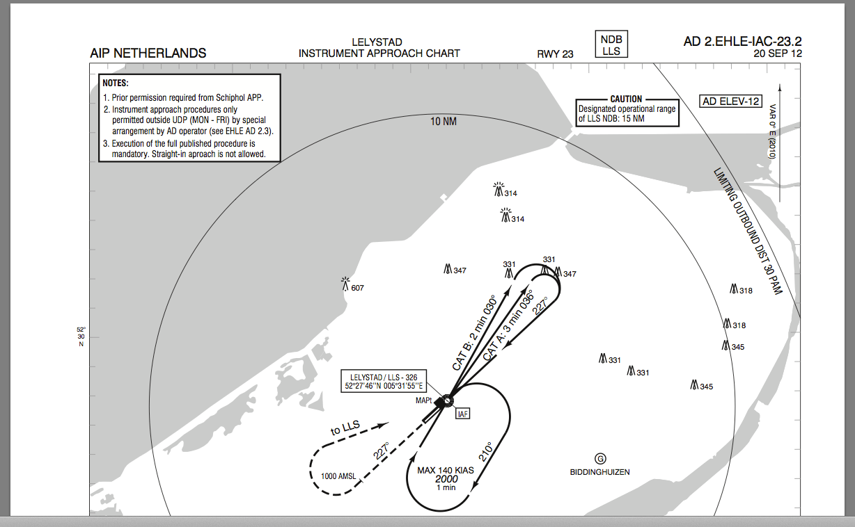
Commercial Plates or AIP Provided Approach Plates
Companies like Jeppesen provide commercial approach plates to pilots. In exchange for a yearly fee, you get plates showing all the relevant information you need, including the minima. In addition, the commercial plates providers present their plates in a consistent manner.
Alternatively, pilots can use the state / AIP provided plates. The state provided plates miss from one state to the other the consistent look-and-feel, but you can get used to that quite fast and easily. Second, there is some information missing on the state/AIP plates, but which can be added using our IFR Minima App for iPhone or iPad. State/AIP plates often don’t show the decision altitude, minimum descent altitude (MDA) and runway visual range (RVR) for the specific approach. The reason this information is often missing is that the state leaves the calculation of these minima to the operators and airlines as the outcome depends on the rules and ops that the operators apply.
Eurocontrol Partnership
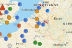
Thanks to our partnership with Eurocontrol, we have access to all the state plates. Eurocontrol provides us with regular and automated updates. Also, we have for each airport in the world relevant information available in our database, such as the runways in use, their threshold height and the aerodrome elevation.
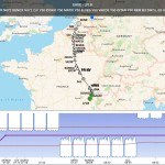
Sample state approach plate provided by our system through our Eurocontrol partnership.
Missing information on the AIP Plates
What is missing from the AIP or state provided plates is the minima information that pilots need in order to decide whether to continue the approach or go into a missed-approach. The information missing is the Decision Altitude/Height (DA), the Runway Visual Range (RVR) minima and in the case of a circling approach the Minimum Descent Altitude (MDA).
The reason why these minima are not there on the government charts is that these figures depend on the operating procedures (ops) under which the private or commercial pilot is flying. For most private and business operations based in Europe, providing the EU-OPS minima numbers to these plates would help pilots a lot in the preparation for each instrument approach they would like to fly. It would provide them with the missing information that is often available only on commercial approach charts.
iPhone | iPad IFR Minima App
AeroPlus developed the AeroPlus IFR Minima App for iPhone and/or iPad users to help pilots calculate the minima based on EU-OPS and thus making it easier for them to use the government/AIP plates while flying IFR in Europe.
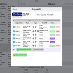
Screenshots of the AeroPlus IFR Minima App.
EU-OPS
The app calculates the minima on the basis of the EU-OPS regulation as provided here. The document starts with a short introduction, then an appendix 1 and appendix 2. Appendix 1 is not applicable anymore. Appendix 2 starts on page 70 and within the first 10 to 15 pages, the EU-OPS minima are specified in easy to read tables and conditions. It is from here that we have taken our calculation of the minima.
What does Compliant NPA mean?
A non-precision approach is compliant with section (c).1.(ii) (on page 73 of the above EU-OPS doc) if all of the following are true:
- Nominal vertical profile not steeper than 4.5 degrees (7,87%) (for CAT A/B aircraft)
- The final approach segment is at least 3 NM
- The final approach track is offset by not more than 15 degrees (for CAT A/B aircraft)
- The fix where the descent is initiated is defined by more than timing alone
- If the MAPt is determined by timing, the distance from FAF to THR is not greater than 8 NM
How are LPV approaches handled?
The LPV approach is an instrument procedure which utilises lateral and vertical guidance but does not meet the requirements established for precision approach and landing operations. It is considered an APV approach.
How do I figure out the lights available on the runway in use?
EU-OPS differentiates between the following approach light systems: FALS (Full Approach Light System), IALS (Intermediate Approach Light System), BALS (Basic Approach Light System) and NALS (No Approach Light Systems). More details on this is found in the FAQ section in our app. Find the runway approach light system on the AIP chart and see how this fits one of the above categories using the information provided in the FAQ part of the app.
OCA and OCH
The AIP or state provided plates always provide the obstacle clearance altitude (OCA) and height (OCH). Together with information on either the threshold or airport elevation and other options available to the pilot, the DA, MDA and RVR can be calculated according to EU-OPS.
Sample flight into Biggin Hill (EGKB)
Lets take, for example, several different approaches into Biggin Hill, where the expected runway in use will be runway 21. The AIP plates used in this example are provided here.
The aerodrome elevation is taken from the aerodrome chart. Right at the top, it states that the aerodrome elevation is 599 feet. The aerodrome elevation is the highest point of the landing area (ICAO). Aerodrome elevation is measured to an accuracy of 1 ft (or 1/2 m).
The approach lights are of the type IALS. HIALS lights (420m – 719m) single source, Barette. The lighting information is taken as well from the aerodrome chart, but might take some practice to relate the information on the AIP/state plates to the correct approach lights category in our app. In a next app version of our app, we hope to make this part easier to use.
LOCALIZER ONLY
For a Localizer only approach (LOC), the OCH (ft) is 323 for CAT A aircraft. This information is found on the LOC/DME/VOR AIP chart for Runway 21. On the same chart, you also find the Threshold Elevation, which is 517 feet.
The other options selected in the app are: Single Pilot, A/P coupled, Compliant NPA, Flying CDFA and CAT A for the Aircraft Category. See the FAQ in the app for a description of all the options available.
As a result, the AeroPlus IFR Minima App presents us with the following minima for an LOC only approach into RW21:
- LOC only
- CAT A aircraft
- DA (ft) = 840
- DH (ft) = 323
- RVR (m) = 1100
Comparing this to e.g. the Jeppesen charts shows that this result is the same.
CIRCLING
If we would take the above LOC approach and would want to circle-to-land to the reciprocal runway, we would have to adjust the OCH (ft) to 551 as shown on the LOC/DME/VOR AIP chart and select Circling as an option in our app.
As a result, the AeroPlus IFR Minima App will show the following circle-to-land minima:
- LOC initial approach, circling-to-land
- CAT A aircraft
- MDA (ft) = 1150
- MDH (ft) = 551
- RVR (m) is 1500
Some comments. In our app, circling minima always relate to the MDA and not to the DA. Also, circling minima relate to the aerodrome elevation and not the threshold elevation. The RVR or VIS (visibility) is taken from the preceding approach, which in this case was the LOC only approach. Values above 1500 meter are depicted as VIS. Up to and including 1500 m it is depicted as RVR. The results are most of the time consistent with those shown on e.g. Jeppesen charts.
ILS DME approach RW 21
Lets as a next example take the ILS into the same runway. In this case, we have to look on the ILS/DME/VOR AIP chart for the OCH (ft) which will now be 164. The threshold elevation stays the same, but the approach type is changed to ILS and Circling is NOT selected anymore.
As a result, the AeroPlus IFR Minima App will show the following ILS DME minima:
- ILS approach
- CAT A aircraft
- Single Pilot
- A/P coupled approach
- Flying CDFA
- DA (ft) = 717
- DH (ft) = 200
- RVR (m) = 750
Again, the results are consistent with e.g. those shown on the Jeppesen charts. Be aware that for the LOC only approach, you have to search for the OCH value on the LOC AIP chart, not the ILS chart. On the Jeppesen chart, the LOC minima will be shown on the same ILS DME plate as LOC (GS out).
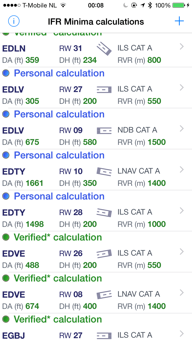
Community Effort calculations
In this latest version of our IFR Minima App, we store your calculations not only on your iPhone or iPad, but also in a central database on one of our servers. That allows us to actually share your calculation with other pilots using the same IFR Minima app. Your own calculations will be called Personal calculations to you, but might be displayed as Community Effort calculations to other pilots using the app. A colour coding system, as well as a so-called Consistency ratio, gives you an indication of the ‘reliability’ of the calculation that was shared with you. Check the ‘Get support’ section in the app on how this actually works. We have a team of specialists that regularly verify approaches that were calculated by pilots using our app. Once they are verified, the Community Effort calculation changes into a Verified* calculation. Of course, even with a Verified* calculation, you remain responsible to always double check the calculation yourself as pilot-in-command.

If you want to use state plates instead of commercial approach plates, then check out our app in the Apple AppStore and add the needed minima values to your plates. And while going at it share your effort with other pilots to make the total effort of calculating the approach minima easier for everyone.